
With eyes in the sky and boots on the ground, farmers have more data than ever with which to make decisions.
The low hum of a drone buzzing in the air. Fixed-wing aircraft gliding over the clouds. Satellites orbiting Earth. The future, as laid out in a sci-fi novel, is now. And agriculture, with its ever-increasing need to manage crops as efficiently as possible, embraces this powerful technology for what it is—another tool in the toolbox.
While those unmanned aerial vehicles (UAVs), satellites and airplanes have the power to get up high, it’s the cutting-edge images they capture that really assist on-the-ground, people-powered decisions, offering increasingly precise data throughout the crop cycle. From plant population, weeds and soil compaction to nitrogen deficiencies, over-irrigation and pests, the powerful snapshots not only help pinpoint where those issues lie in a field, but why, and what solutions are possible.
What the Images Can Tell Us
Each plant in a field is, in essence, its own sensor. Its unique surface and texture provide a sort of data signature in the form of reflected light. Multispectral imagery captures those reflections and, in turn, can provide insight to the health of the plant.
So, when you view a normalized difference vegetation index (NDVI) or a normalized difference red edge index (NDRE), it’s simply a calculation of visible and near-infrared light reflected by that vegetation. Or, says Darren Goebel, agronomist and AGCO’s director of global commercial crop care, “it’s the intensity of photosynthesis occurring in the plants.”
More specifically, the red spectrum of an NDVI map is highly sensitive to low chlorophyll, while the red edge spectrum is sensitive to a wider range of chlorophyll. Other than that, the two types of images basically do the same thing—reflect photosynthetic activity.
In practice, then, red areas in NDVI images could indicate a dead crop, bare soils or even a building. Conversely, adds Goebel, “green areas in an image may indicate a very healthy growing crop, and the darker the green, the healthier the crop.”
Improving Imagery Through Research
Think of imagery research as a bit of an agricultural arms race. “Two years ago, the whole industry was concerned about the UAVs and what they could and couldn’t do”—from limited battery life and FAA regulations, says Terry Griffin, assistant professor, department of ag economics at Kansas State University and faculty adviser to the Kansas Ag Research and Technology Association (KARTA), a group of producers who share their technology and on-farm experimentation. “Everyone was ignoring what UAVs actually did—take images—and they were more concerned about the hardware.”
But, he adds, that interest in the hardware has actually driven the research toward better imagery. These days you’d be hard-pressed to find a university or equipment company not involved with some type of imagery or UAV research.
Many producers and agronomists are increasingly using UAVs, as well as fixed-wing aircraft and satellites, in farm operations to produce images, such as NDVI and NDRE.
“Traditional NDVI and multispectral images have been around for many years,” says AGCO’s Goebel. “But there’s a lot of work going into the continued utilization of very specific portions of the visible light spectrum,” he adds, citing the accepted use of red edge (NDRE) in more accurately pinpointing in-field nitrogen deficiencies.
“Scientists are still working to determine which wavelengths can tell specific weeds apart,” says Dennis Bowman, a crop systems educator at the University of Illinois Extension. “You can definitely see a difference in the reflectance of waterhemp versus soybeans, but at a practical, commercial level, we still can’t tell waterhemp from velvetleaf.”
At Mississippi State University, researchers recently published a study that deployed UAVs over corn plots to assess different drydown rates once corn hits the black layer and starts senescing. Jason Ward, who joined AGCO this past fall as the Global ATS precision farming training manager, was involved in the study as assistant Extension professor, focusing on precision ag research.
“We wanted to see what the variability was around multi-hybrid planting,” he says. The researchers found significant differences in drydown rates across hybrids. “What that means to me,” Ward explains, “is the difference was large enough that it could impact performance of the combine and could impact actual yield estimation.”
This year marks the first that AGCO’s Crop Tour will fly drones over fields to collect imagery, using reports and analytics from ag insight company Aglytix to “provide head-to-head evaluation of the planters and different production methods and tools,” says Ward. “Say we’re looking at output from our SeedSense® 20/20 [monitor], and we see the singulation came out nicely, downforce map was consistent, no big issues in the field area, but we still have a stand problem. Maybe the seed just didn’t establish right.” Hopefully, he says, “using the imagery and technology for context, you’ve been able to cross some things off the list so you can drill down to your most actionable piece of the problem.”
As Ward explains, use of this technology may not allow a fix until the next year. Yet, based on the data layer, you can start asking yourself what you need to do differently, how you should manage weeds or whether you should change your fertilizer package. “And you may be able to budget ahead of time for some of those things,” he says.
Boots on the Ground
“A lot of companies talk about how aerial images are good indicators of what your yield map looks like,” explains Goebel. “But as an agronomist consulting with growers, I actually don’t want those images to look like my yield map,” he says, explaining he needs multiple factors reflected in those photos to help make better decisions. “I want to see what’s going on in the field—nitrogen management, weeds, insects—and use the imagery as a scouting tool to help affect change.”
Even the most high-tech layers of data aren’t a substitute for scouting. “You’re still going to have to walk to those spots, maybe take a soil or tissue sample, and then make a decision about what to do,” says Goebel.
“With a nitrogen deficiency, you’ll have to go out and very likely variable-rate-apply nitrogen. I can take that NDVI image, pull it into software and create a prescription nitrogen map, and then load it back into the sprayer to apply nitrogen or urea in spots that need it.”
The whole goal of advanced imagery—of these futuristic drones hovering over a field of beans or corn—is to gather data and context, provide benchmarks potentially allowing farmers to help reduce costs, and maximize efficiencies and returns. Still, producers need to interpret that data correctly and make smarter decisions based on it. Because, points out Ward, “in precision ag, we’ve been really good at generating large volumes of data, but not great about making it completely actionable … yet.”
So, while producers and researchers continue to leverage imagery, hardware and software to identify in-field issues and increase productivity across operations, Ward acknowledges there’s plenty of on-farm information that needs to be applied toward those analytics and algorithms. “Lots of local information comes from a farmer being there, knowing his field, his equipment, his operators. And that,” he points out, “frankly, doesn’t fit well into a database.
“I don’t think,” he concludes, “that we’ll ever be able to take the farmer’s brain out of the equation … and I don’t think we’d want to.”
Article written by Claire Vath, AGCO
The Precision of Precision Farming
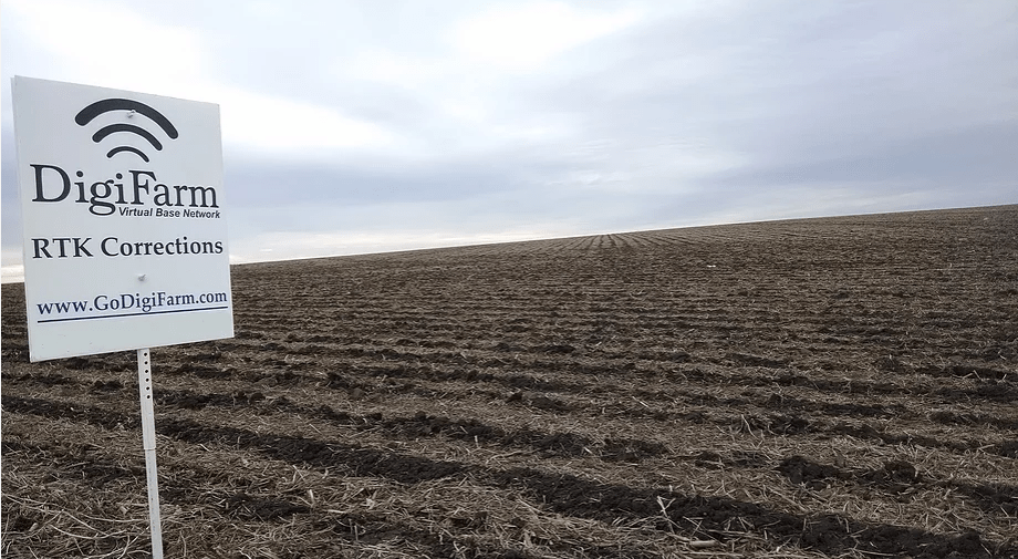
Precision farming technology continues to change and advance our farming practices. Auto-guidance, auto-steer and a host of other GPS-guided systems improve accuracy and efficiency in operating tractors and equipment. Even the best technology can suffer from disruptions, decreasing the accuracy or signal reliability. Correction services can vastly improve the efficiency and precision of your precision farming systems, helping you maximize your time, inputs and yields.
DigiFarm has been a proven leader in providing correction services across the Midwest via cellular based RTK. The multi-base network provides sub-inch pass to pass and year to year repeatability. DigiFarm VBN (Virtual Base Network) provides maximum accuracy and reliability by delivery corrections through a network of virtual base stations, using a wireless connection to secure servers.
DigiFarm is compatible with all major brands of GPS receivers, making it easy for users to efficiently move the DigiFarm beacon between multiple different systems or brands. The plug and play system allows for easy set-up and transferability. The true virtual base station constantly updates your position for extreme accuracy.
A vast network of DigiFarm base stations send data via the internet into central servers where the data is processed for clients to use. A cellular modem is installed in the tractor cab and is connected to the GPS receiver so that a wireless data connection can be established between the tractor GPS receiver and the DigiFarm servers.
The GPS receiver on the tractor sends its position into the DigiFarm servers through the cellular modem. The DigiFarm servers respond by creating a virtual base station in close proximity to the tractor and transmitting corrections to the tractor’s GPS receiver through the cellular modem. By creating a virtual base station for each vehicle that logs into the network, DigiFarm is able to offer superior accuracy compared to that of a single base RTK provider. This also provides exceptional redundancy and reliability.
Call us for a demo today to see how RTK Correction services from DigiFarm can increase your operation’s efficiency and productivity!
www.swiderskiequipment.com/–digifarm
Technology continues to change planting practices, allowing growers to maximize efficiencies while reducing inputs during the crucial planting season. Swiderski Equipment is proud to offer Precision Planting technology to our customers as a Premiere dealer and took a group of 20 customers to the Winter Conference January 18-19, 2018 at the Precision Planting headquarters in Tremont, IL.
The group learned about the various Precision Planting products and their return on production and efficiency to each operation. The group also saw the unveiling of new technology from Precision Planting. Below is a recap of new products for 2018.
The company also announced the opening of the Precision Technology Institute (PTI) located in Pontiac, Ill., a 200-acre farm to serve as an agronomic research site, as well as a location where farmers can experience Precision Planting technologies and products in a real-farm environment.
“As Precision Planting continues to look for opportunities to improve the way we plant, we are actively investing in progress and development for the future. Today we launched new technologies that address real problems and are another step toward helping farmers become smarter every season,” said Brad Arnold, Precision Planting general manager. “The establishment of the PTI in Pontiac will enhance our research efforts and help us demonstrate how precision agriculture can enable farmers to increase yields and ROI by ensuring the seeds they plant maintain their top-end yield potential at emergence, while keeping input costs to a minimum.”
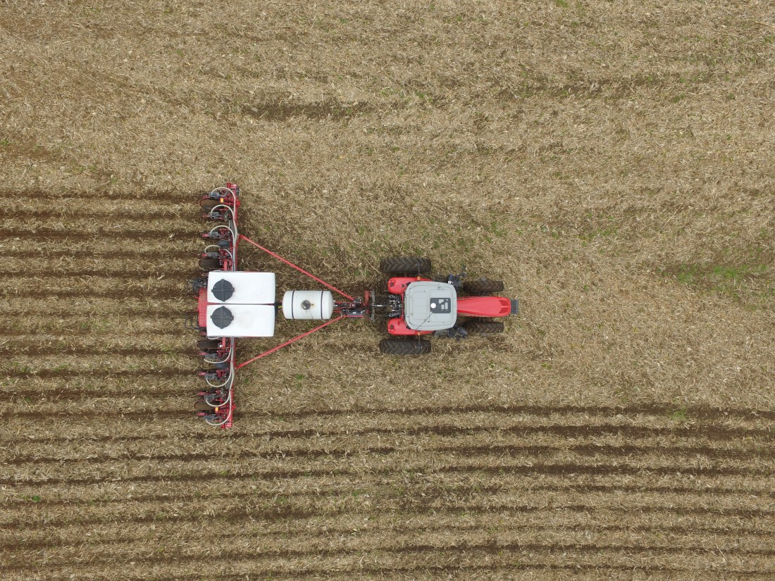
The new products launched include the 20|20® monitor, which provides an advanced agronomic picture, allowing farmers to optimize planting, harvest and application decisions with a smart, intuitive interface that visualizes performance and field conditions in real time. The 20|20 monitor powers the most agronomic-advanced systems on the market that control population, down force, liquid application, multi-hybrid planting and higher-speed planting, all while sensing the furrow. The 20|20 monitor also helps collect the most spatially accurate yield data available and provides information for setting the planter to maximize ear count. This allows farmers to not only have the accurate data to make those crucial decisions but also gives them the equipment and powerful automation to make decisions during each pass through the field.
The new SeederForce™ is the first step toward bringing Precision Planting technology into the air-seeder market. Compatible with John Deere 60 and 90-Series Air Seeders, SeederForce is an automated downforce control system that initially measures the amount of weight present on the gauge wheels of the row unit and compares that to the target set by the farmer on the 20|20 display. SeederForce then automatically changes the hydraulic pressure present on the rockshaft cylinder to increase or decrease the row unit down force to maintain the target weight set by the operator, resulting in a more consistent seeding depth and more uniform emergence of the crop.
For switching between hybrids when crossing into different zones, the new mSet™ allows for two hybrids to be planted in the field using a single meter with a dual compartment hopper and a seed selector. The seed selector fills the vSet® meter with a small pool of the hybrid being planted, and when it’s time to plant the other hybrid, it fills the meter with the second hybrid from the other section of the hopper. Transitions happen quickly thanks to a seed pool level sensor that tells the seed selector when more seed is needed. mSet is compatible with both seed tubes as well as SpeedTube® for maximizing acres per hour and gaining profitability from multi-hybrid planting.
For more information on any of the Precision Planting products or how to upgrade your current planter, contact our Precision Farming Division.
